The issues below primarily apply only to developments not claiming California state jurisdiction. Since 2018, state housing laws have superseded local city control.
DEVELOPMENT ISSUES
|
There are many issues to be considered when reviewing new residential development proposals. Below is information about some of the most common issues that have been discussed.
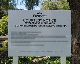
Send your comments to the city planning staff assigned to the development. Their email is posted on each development's Shape Our Fremont page. Write the planning commissioners and the city council members. See their mail and email addresses on the Contacts page.
Go to the developers' community meetings and share information with your neighbors. Attend city meetings and voice your concerns. See the Meetings page for times and places.
Housing Density
The allowable housing density for a development is determined by the land use designation of the property in the Fremont General Plan. For each designation, there is a range of allowable density measured in dwelling units per net acre or "du/ac".
City of Fremont General Plan
Net acreage doesn't include land used for non-buildable areas, such as public streets and utility easements.
Residential Land Use Designations:
Low: 2.3 to 8.7 du/ac
Low-Medium: 8.8 to 14.5 du/ac
Medium: 14.6 to 29.9 du/ac
Urban: 30.0 to 70.0 du/ac - Within a TOD area: 50.1 to 70.0 du/ac
Hillside: Less than 8.7 du/ac where previously subdivided; less than 2.3 du/ac elsewhere
If a development is a Planned District, the developer is allowed to vary the lot sizes and locations of the dwellings as long as the overall density of the project is within the allowable range. In some cases, this can result in the dwellings being placed more closely together in one area of the property. If affordable housing units are included, the city may allow the developer to increase the overall net density under certain conditions.
The number of stories, floor area, and setbacks from surrounding buildings do not affect the density calculation.
See more about density issues in our ![]() Housing Density article in
Housing Density article in ![]()
General Plan Land Use Amendments
Developers can apply for a General Plan Land Use Amendment to change the Land Use Designation of a specific parcel. This is often done to change the land use from commercial to residential, or to increase the residential density from one level to a higher level. Developers have to get the landowner's permission or purchase the land ahead of time and become the landowner.
Residents can also apply for an amendment, possibly to decrease the density, but they too have to get the landowner's permission. Landowners stand to benefit from an increase. The developer may be the landowner. Residents have to argue their case against amendments for increase but the developers and landowners aren't made to fight against decreases - residents just aren't permitted to apply for an amendment without the landowner's permission.
If a proposed development, that is not an Affordable Housing project, requires a General Plan Land Use Amendment, it must first go through a General Plan Amendment Screening to determine "the overall desirability of considering the project in light of affordability, sustainability, community benefit and other long-term planning goals." This Screening Review will be done twice a year. Requests must be submitted by June 15th for screening in September or submitted by November 15th for screening in February.
The current General Plan was adopted in December 2011. The City Council felt it was a good plan and intended to follow it for the next 15 to 20 years. Changing the plan on a year-by-year, lot-by-lot basis is a serious matter that can affect several other agencies. For example, the Alameda County Water District, the Union Sanitary District, and the Fremont Unified School District all base their long-range growth predictions, in part, on the general plan. Likewise, the California Department of Transportation (CalTRANS) bases their traffic evaluations for certain State highways, like Mission Boulevard and others, on the general plan.
General Plan Amendments should be given a close review, not only by the Planning Department, but also by the residents of Fremont. Residents might ask how the amendment is going to affect the nearby homes and businesses, the schools, the water and sewer service, the traffic on the streets, and the look and feel of the community as a whole.
Water Supply
The Alameda County Water District (ACWD) provides water service to Fremont, Union City, and Newark. In 1995, the district implemented a process known as Integrated Resources Planning (IRP) to evaluate and balance water supply with water demand as the area grows.
As part of the process, ACWD makes long-range forecasts of water demands by combining current usage with projected growth based on each city's General Plan and the Association of Bay Area Governments Smart Growth predictions.
ACWD also makes long-range plans for water supplies by expanding current sources and acquiring additional sources or storage facilities.
To avoid any negative impact from very large developments, ACWD prepares a Water Supply Assessment for each development that exceeds 500 housing units or a certain number of square feet of commercial or industrial space. Based on the assessment, the developer may have to alter the design to decrease water demand or provide funds to increase water supply.
All concerns and issues regarding the impact of new developments on water service should be addressed to the Alameda County Water District. To view their website, go to www.acwd.org
See more about water supply issues in our ![]() Impact of New Housing on Water Service article in
Impact of New Housing on Water Service article in ![]()
Traffic
Each proposed residential development is subject to a traffic impact review. Developers are not held responsible for the cumulative impact of all the new housing along the development's adjacent street(s) - only their one project.
Fremont uses the Institute of Transportation Engineers (ITE) standards for traffic studies. The trip generation calculation gives a lower rate for townhouses than for single-family houses of the same square footage or number of bedrooms. And even for single-family houses, they say that it will generate, at most, one daily car trip per house.
Many of the proposed units are large traditional single-family houses or just-as-large three-story townhouses. They have three to five bedrooms and will likely have at least two cars per household - either two commuters or one commuter and one school transporter.
If the city has already designated a traffic intersection as having an unacceptable Level of Service (LOS), the development won't be denied for traffic reasons unless "the addition of the project causes the intersection average control delay to increase by more than 4 seconds per vehicle."
Changes to traffic controls on State Highways such as Mission Blvd. (State Route 238)
and parts of Thornton Ave., Fremont Blvd. and Peralta Blvd. (State Route 84),
are subject to Caltrans approval and the city uses that to justify why they don't hold developers responsible for traffic problems.
Developers sometimes offer to finance installation of traffic calming devices such as speed bumps/humps/lumps. In order to implement installation of speed lumps, the City's requires the support of 70 percent of the residents living along the affected street segment and 75 percent of the residents adjacent to each proposed speed lump location. See the Residential Traffic Calming Program.
There is traffic generated by the FUSD school attendance areas for new students being at whatever school has room. Some parents have to drive their children to multiple schools around town. This traffic impact is not included in the traffic impact studies.
See an in-depth look at Mission Blvd. traffic in our ![]() A to F: Development Along Mission Boulevard Slows Traffic article in
A to F: Development Along Mission Boulevard Slows Traffic article in ![]()
Parking
Single-family dwellings with up to four bedrooms require a minimum of 2.0 spaces per dwelling for residents. Dwellings with five or more bedrooms require 3.0 spaces. There is no minimum requirement for guest parking.
Multi-family dwellings outside TOD areas with a studio or one bedroom require a minimum of 1.5 spaces per dwelling for residents and guests combined. Dwellings with two or more bedrooms require a minimum of 2.0 spaces combined.
Multi-family dwellings inside TOD areas with any number of bedrooms require a minimum of 1.25 spaces per dwelling up to a maximum of 1.75 spaces for residents and guests combined. The parking requirements in TOD areas are set lower than in other areas to encourage the use of public transportation and walking.
Spaces with additional side clearance and an access ramp to the sidewalk for disabled persons are required, but the quantity is not specified. Spaces with rechargers for electric vehicles may be required in accordance with the California Green Building Code.
See more about parking issues in our ![]() Parking in New Housing Developments article in
Parking in New Housing Developments article in ![]()
Transit Oriented Development (TOD) Overlay:
The General Plan 2011 - Chapter 2: Land Use states:
"Transit Oriented Development (TOD) is an overlay designation applied to areas generally within a 1/2 mile radius of the Fremont BART Station, the future BART Stations in Irvington and Warm Springs, and the ACE/Amtrak Station in Centerville. The Overlay only applies to property with
an underlying designation in one of the seven commercial and industrial categories, or the Urban Residential category. Each TOD area is unique. However, they share a common goal of maximizing transit use through density, land use mix, building form, and design. Each TOD is intended
to be a vibrant pedestrian-oriented district. The particular mix of uses around a given station will vary depending on surrounding land use, access, infrastructure, and other factors. TOD areas will generally have more intense development than immediately surrounding areas in order
to support transit ridership and promote a sense of place. Low-intensity auto-oriented uses that do not take advantage of the proximity to transit will be discouraged."
See more about TODs in our ![]() Transit Oriented Development Overlays - TODs article in
Transit Oriented Development Overlays - TODs article in ![]()
Fremont Unified School District Attendance Area AssignmentsTwice a year, the Fremont Unified School District (FUSD) reviews all the school Attendance Area assignments for one year and six years into the future. This includes tentative assignments for students from new developments. An assignment can be "Unassigned". Because many schools are currently overloaded, FUSD has stated that new students will be assigned to whatever closest school has room in their grade's classroom even though it may mean that students from the same family are assigned to different schools. This is not part of the City of Fremont's Residential Development Application process. The Planning Commission and the City Council are not involved in the Attendance Area assignments. Any issues residents might have with School Attendance Area assignments should be addressed to FUSD. |
|
Development Impact on School Facilities
California's Senate Bill 50 (SB50) prohibits cities from considering the impact on schools when reviewing a residential development application. It prohibits requiring developers to mitigate their project's impact on schools.
Cities can encourage developers to voluntarily fund new school facilities.
The Leroy F. Greene School Facilities Act of 1998 (Senate Bill 50)
Earthquake Faults
The Hayward Earthquake Fault is one of the most active in California. In Fremont, it passes through Warm Springs, runs through Irvington and along the western edge of Lake Elizabeth, and then exits near Niles. The southern portion of the fault, centered roughly at the intersection of Washington Boulevard and Driscoll/Osgood Road, has a 22.3% probability of having a magnitude 6.7 or higher earthquake in the next 30 years -- the highest probability of a major quake in the San Francisco Bay Area.
To prevent new housing from being built directly on top of earthquake faults, the
Alquist-Priolo Earthquake Fault Zoning Act was passed by California in 1972. It prohibits construction of dwellings within a certain distance of a fault centerline -- usually 50 feet on either side. This applies to new houses, apartments, condominiums, etc. It does not apply to one- or two-story single-family houses in developments of three dwellings or less, nor does it apply to dwellings built before 1972 unless those older buildings undergo a major remodeling.
In 1990, the Seismic Hazards Mapping Act was passed to require identification of other earthquake hazard areas, including land that would be subject to liquefaction or landslides as a result of ground shaking. Building on these areas is either prohibited or requires special considerations.
The presence of earthquake fault zones and earthquake hazard areas are reported as part of the Initial Study for all new housing developments.
Fremont Municipal Code Earthquake Hazard Building Regulations:
Title 15 - BUILDINGS AND CONSTRUCTION Division 3. Earthquake Hazard Reduction and Retrofit
15.70 Earthquake Hazard Reduction Requirements and Minimum Standards for Existing Unreinforced Masonry Buildings
15.75 Earthquake Retrofit Standards and Requirements for Soft-Story Residential Buildings
15.80 Earthquake Hazard Reduction in Existing Tilt-Up Concrete and Reinforced Masonry (TRM) Buildings
Reporting Concerns Once Construction Starts:
The contractor is responsible for meeting the City of Fremont's requirements to minimize disruption and potential damage during construction. For example, trucks hauling dirt must prevent spillage on the street. Fences and landscaping on surrounding properties must be protected. Construction hours, including equipment warm-up time, are 7 a.m. to 7 p.m. on Monday-Friday, 9 a.m. to 6 p.m. on Saturday, with no construction allowed on Sunday.
There should be one or more signs on the project site with the name and telephone number of the contractor's community coordinator for the project. This person should be called first for all concerns and complaints about work on the site. Emergency situations, such as fires, should be reported by calling 911.
If the contractor does not resolve a problem, or if a problem happens repeatedly, the City of Fremont's Community Preservation department should be contacted at (510) 494-4430 or code_enf@fremont.gov.